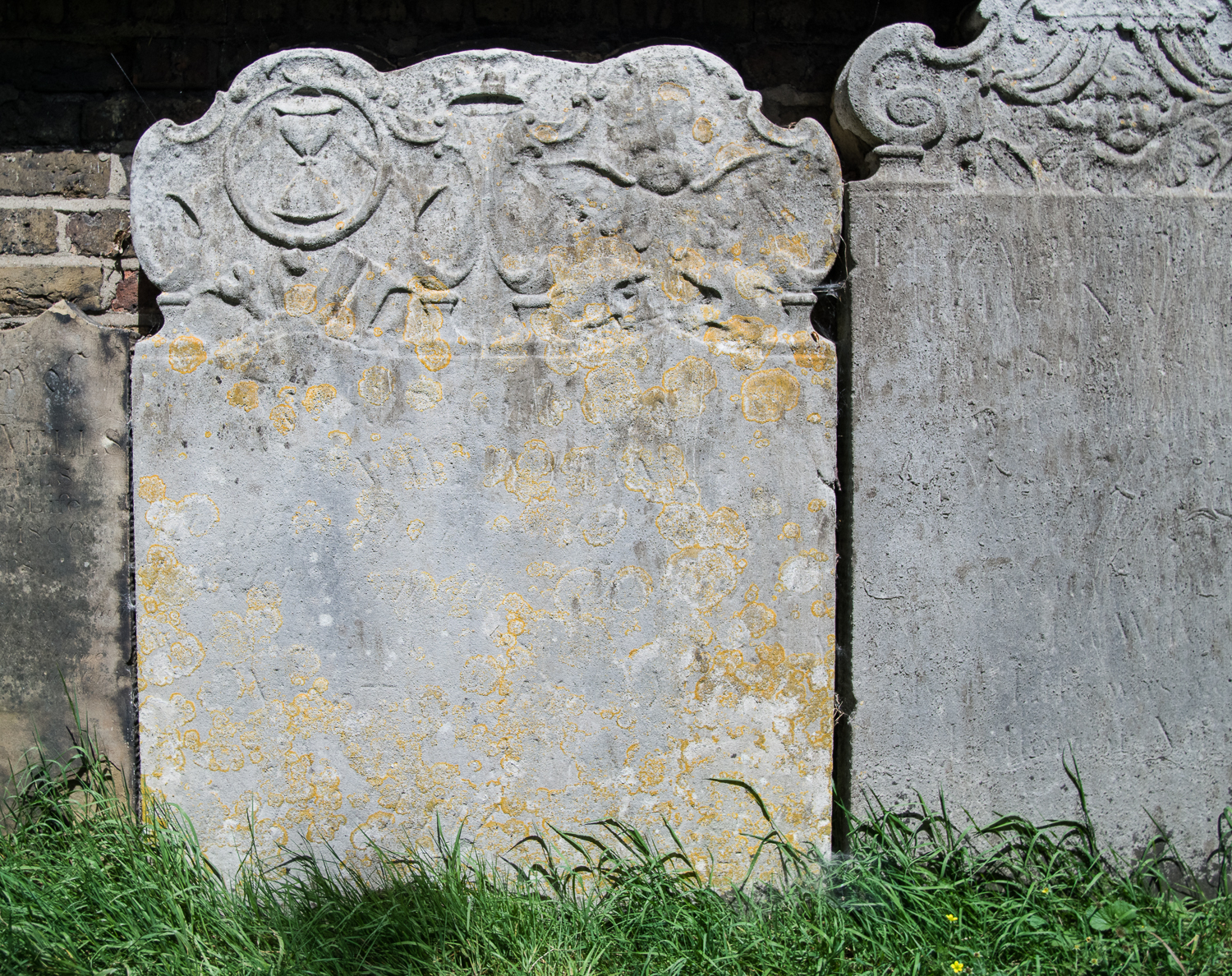
Last year I was asked by Ken Walton from the Institute of Archaeology, on behalf of Chris Baker (Director of Dartford District Archaeological Group) and Dr Mike Still (Curator of Dartford Borough Museum), if we would be willing to undertake some survey in Dartford, specifically in “St Edmunds Pleasance”, a small disused cemetery which is used now as a park. Sadly, the majority of the headstones — including some lovely eighteenth century examples with memento mori (Fig. 1) — have been moved and are now around the edges of the area.
The larger chest tombs have been left in place (Fig. 2). The cemetery also has a monument to the Dartford martyrs (Fig. 3). This monument was built in 1851 in memory of three protestants, Christopher Ward, Nicholas Hall and Margery Pollen, who were burnt at Dartford in 1555. The monument is listed.


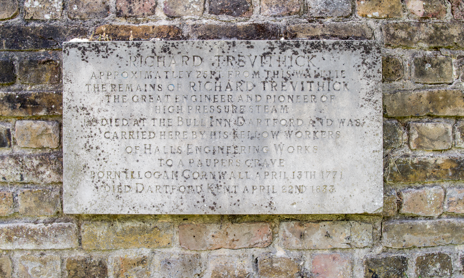
Perhaps the most interesting aspect of this cemetery, however, is that it is the final resting place of Richard Trevithick. Trevithick was a Cornish engineer and inventor. He designed and built a number of high-pressure steam engines. One of those, the Catch-me-who-can ran on a circular track just south of Euston, now identified as being located on the site of the Chadwick building at UCL. Trevithick died a pauper in Dartford in 1833 and was buried here in a pauper’s grave (Fig. 4).
So, what has all this to do with geophysics? Apparently, Trevithick’s colleagues who buried him were afraid of body snatchers:
It is interesting to learn of the special steps which were taken in those days to defeat the body snatchers. Thomas Aldous, who was at the works from 1843 to 1879, told the author that his father who was one of Hill’s workmen at the funeral. He described the coffin as being fitted with two long stout pieces of timber placed at right angles to the coffin above and two pieces below: these were strongly bolted together so as to clamp the coffin between them, and as a further precaution the nuts of the bolts were under the bottom timbers so they could not be disturbed from above. It is obvious that to get the body out the who structure must be removed necessitating the excavation of an enormous hole.
Evarard Hesketh (1935). J. and E. Hall Ltd 1785-1935, p.14.
My worry about this story is that it sounds a little at odds with “a pauper’s grave”, although Trevithick died only five years after the infamous case of Burke and Hare which may lend it more credence. If true, however, there should be at least four vertical iron bolts. Iron objects on end have a distinctive signature in magnetometry data. They usually have a strong positive reading as a small point and then a “halo” of negative readings around them. It was a very long shot, but it was worth a day trip to Dartford, so in July last year (2022), Jim, Ruth and I headed to the cemetery to undertake a day’s survey.
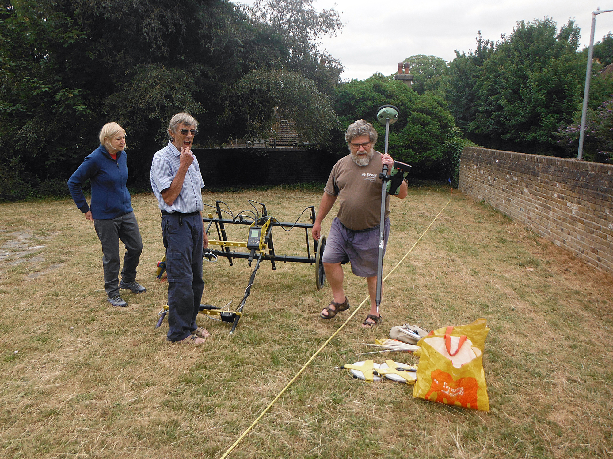
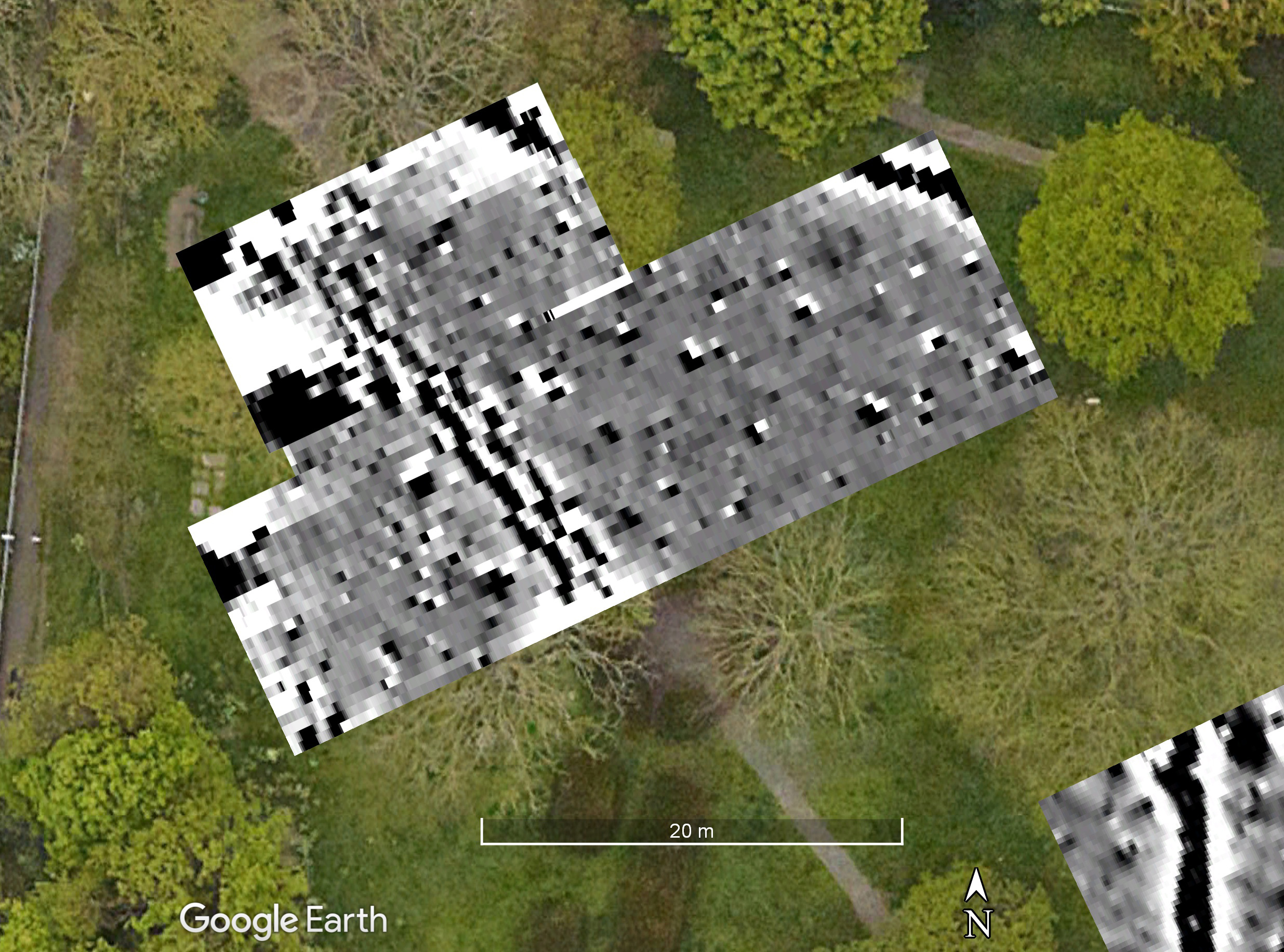
The survey took place when we were using the Foerster magnetometer. This meant that we had to lay out a rather complex set of grids and indulge in quite a bit of wheel spinning. This made the survey slow given the head scratching involved, not helped by the many trees which blocked the GPS signal (Figs. 5 and 6).

We managed to survey three areas: one near the plaque on the wall, one near a second entrance which might be where Trevithick was buried, and a third out of interest due to some parch marks in the grass (Fig. 7).

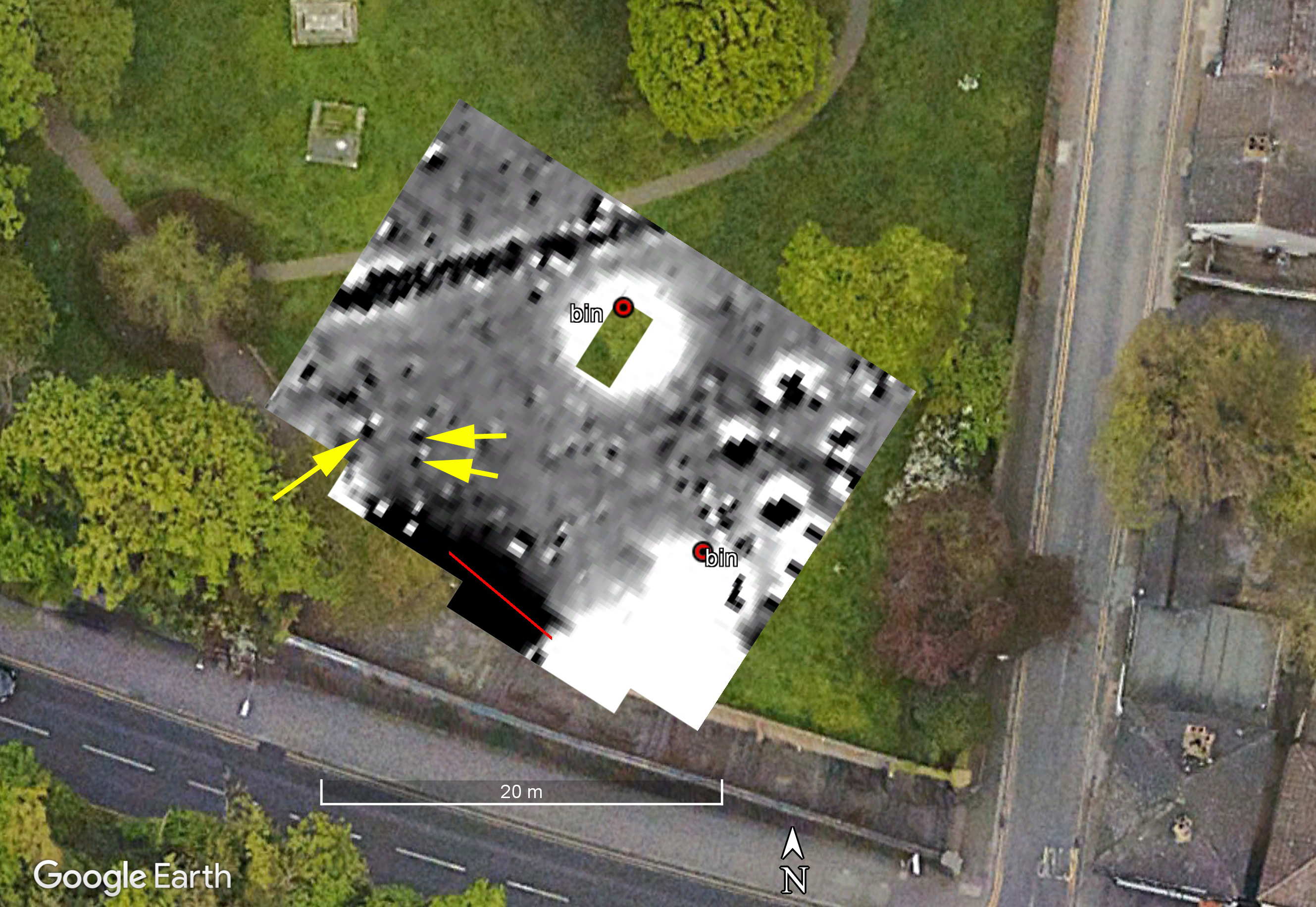
In area one there are a number of ferrous items: two bins on steel bases and an area of fencing along the wall, as well as two paths, one a decorative sinuous path of crazy paving and the other a tarmac path (Fig. 8).

The mag results are shown in Figure 9. For reasons I haven’t managed to sort out, the survey is about 2m further south on the Google Earth image than it should be. As can been seen, the dark line representing the tarmac path in the mag data does not quite line-up with the actual path. I’ve marked the two bins, and the red line represents the railings. Significant areas of the survey are masked by strong ferrous responses like the bin and the fence. There are also some big ferrous objects in the eastern half of the survey. There are, however, some weaker features. I have marked three with yellow arrows. East-west they are 2.5m apart and north-south 1.5m. Are these Trevithick? I think I am grasping at straws but I guess it is possible, although perhaps unlikely.
Area 2 was chosen as it is near the second entrance to the cemetery and some of the sources can be interpreted as saying Trevithick was buried there. The large number of trees made surveying in the grid very difficult, and again the mag is not quite in the right place (Fig. 10). We can see, however, that really the only thing that shows is the iron work on the western edge of the area, and the two paths which cut across it.
Area 3 was chosen for different reasons. It lies in a relatively open area of the cemetery, and had some interesting looking parch marks. There had been a chapel but this had largely gone by the 18th century and we are unsure, exactly, where the chapel lies. We were hoping the parch marks might show us the location of the chapel. It was, thankfully, a relatively straightforward block of mag data to collect at the end of our day (Fig. 11).

In Figure 11 the linear feature marked with yellow arrows is the classic signature for an iron service pipe, either water or gas probably. The fact it heads directly towards the gate in the eastern wall is not a surprise. The dark line indicated with the light blue arrows looks like other paths we have seen in the park, but this one is clearly completely over-grown. Finally, there is the curious circular feature in the middle of the plot. Aerial photographs in Dartford Museum from 1960 and 1971 show that there was a ornamental feature here. The 1960 photograph also clearly shows the path we have mapped. The 1960 photo shows that the tombstones had been moved by that date and that the park was well-tended with circular flower beds.
Although the mag results were not very exciting, the prospect of finding the “missing” chapel drew Mike Smith and I back to Dartford in August 2023 with the GPR. The new GPS that is normally on our Sensys magnetometer freed us from having to work in traditional grids, and has fewer problems with the tree cover (Fig. 12).

We surveyed two area: one roughly coincident with Area 1 and a second in the hopes of locating the chapel in Area 2. The advantage of using the dGPS is that it saves on laying out grids, and you get a cool map of where you have been (fig. 13)!

The GPR survey in Area 1 picked-up the tarmac path and the crazy-paving horse-shoe shaped path, but very little else. Figure 14 shows timeslice 5 (10.5 to 12.5ns) and Figure 15 shows slices 2 to 10.


I was very surprised at how little was showing and how persistent the surface features are. I very much doubt that the crazy-paving path was more than a few inches thick, and yet it persists in the slices down through the sequence. Looking at the amplitude profile (aka ‘radargram’) we can see that we are getting very little real depth penetration (only to about 15ns). The horizontal banding that can be seen in Figure 16 is typical of radargrams before they have had a “background removal” routine performed on them. This image, however, is of a radargram after background removal!

This suggests we have not got a very deep penetration and almost everything we are seeing is either at the surface or just below. I’m investigating why as conditions should have been OK on this site.
The second survey which overlapped with Area 3 of the mag survey showed some interesting features. Figure 17 shows the third time slice (5.9 to 9.4ns, 0.3-0.5m below surface). The double-circle is the garden feature which shows in the 1960 photograph with a path coming off to the west. This path joins the one shown by the light blue arrows in Figure 11 and can also be seen in the photo. The discontinuous nature of the circle on the northern side is probably because the service shown with yellow arrows in Figure 11 cuts through the circle at this point.

Looking slightly deeper there is quite a strong reflection marked in Figure 18 with a yellow arrow. This corresponds to an area of ferrous noise seen in Figure 11 marked with a red arrow.

This big feature shows clearly in the radargrams (Fig. 19, red arrow).

Given the size of the feature, its orientation and the complex reflections shown in the profile, I suspect this may be a burial vault which would have lain under a monument like that shown in Figure 2. Compare the size and shape of it to the one which can be seen near to the road in Figure 18. Some of the other “blobs” (technical term that!) may be similar things. There is also a faint hint of the service in Figure 18 as shown by the blue arrows.
Despite our best efforts both Trevithick’s grave and the chapel eluded us. But we had two pleasant days none-the-less. Thanks to Ruth, Jim and Mike for their hard work, and to Ken Walton, Chris Baker and Mike Still for setting this up, to the Dartford District Archaeological Group for hosting us and the Forrester’s pub for letting us use their car park and a nice pint of real ale at the end of the day (Figure 20)! Many thanks also to Dartford Borough Council for allowing us to undertake these surveys. Perhaps next year we could try res…

