On Sunday 25th February 2024 a small team consisting of members of CAGG and the CVAHS met at Seer Green in Buckinghamshire to explore a site that was seen in the lidar data collected by the Chilterns Conservation Board’s Beacons of the Past project (Fig 1). The lidar indicated quite clearly the presence of a quadrilateral enclosure. On site, the outline of the enclosure could be seen quite clearly through the grass.

The enclosure can also be seen in the March 2022 imagery available from Google Earth (Fig. 2).

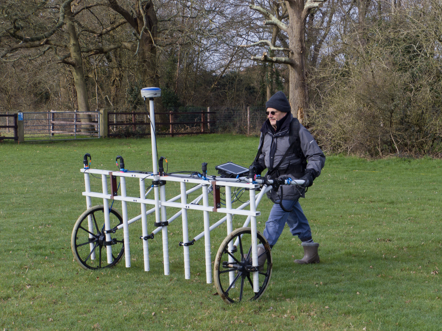
Although it was pretty chilly the ground conditions were good with short grass and not too much mud (Fig. 3) so we were able to complete the whole field in a day, some 2.4ha.
After supper Jim West and I processed the data with high expectations. They were somewhat dashed (Fig. 4).
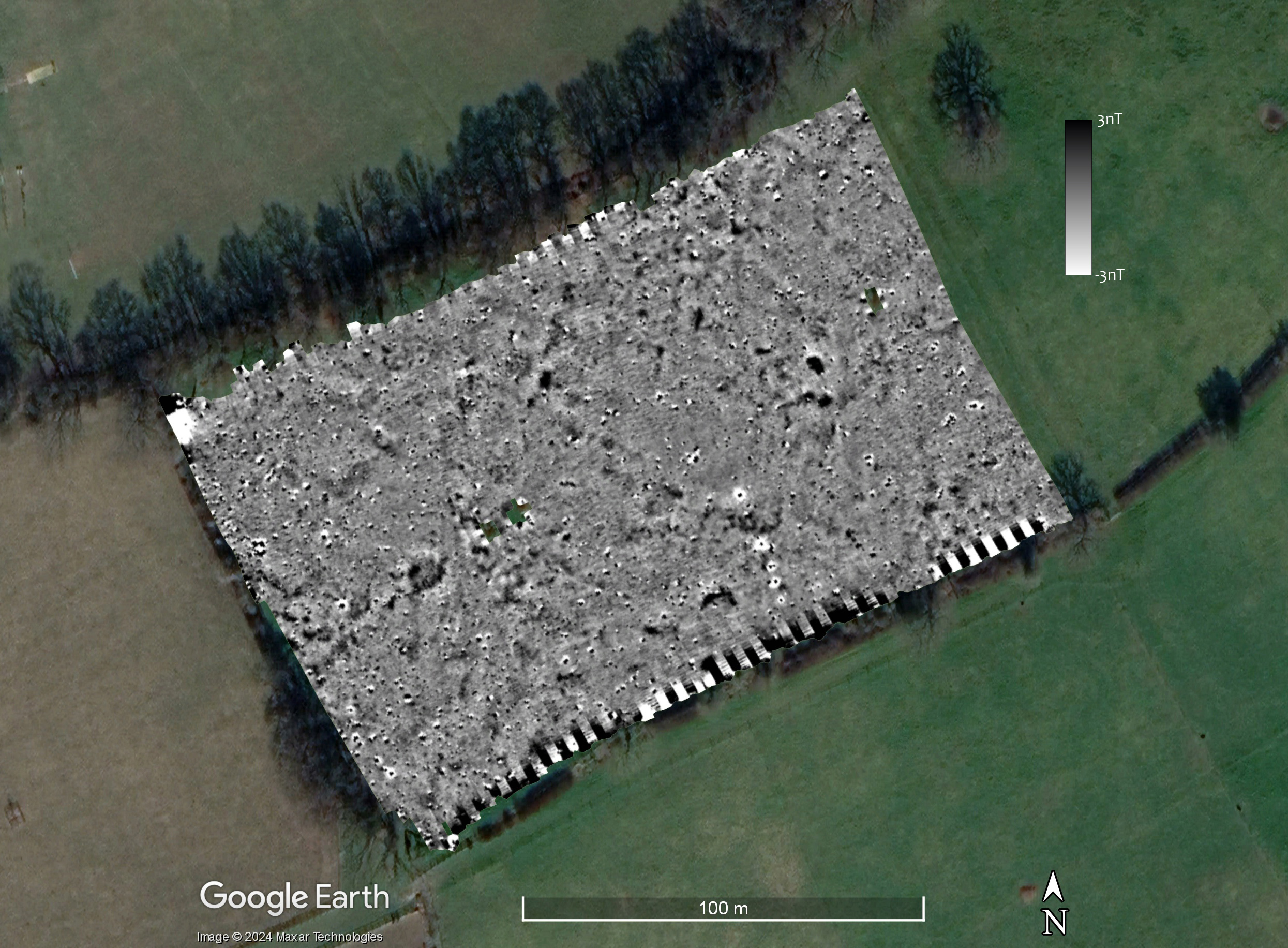
As can be seen from Figure 4, the enclosure does not show in the mag results at all. This is very disappointing. We should keep in mind, however, any geophysical survey technique does not always detect subsurface features: there has to be some contrast in the property being measured. A good example is the colonnaded “palace” building at Verulamium which does not show in the mag at all but shows in the GPR data very clearly.
In Figure 5 I have added a crude outline of the “enclosure” created by simply drawing a line around the vegetation marks in the Google Earth image. Although the large “ditch” does not show, there are some features in the mag data. I have indicated one with the red arrow.

So although we didn’t detect the enclosure ditch, there are some features in the data. I have indicated just one with a red arrow in Figure 5. This is a roughly rectangular feature about 5m long and 2.5m wide. Just on its southern edge is a smaller “dot” of high readings with a corresponding low magnetic reading. In Figure 6 I have taken a screen shot from TerraSurveyor where I have drawn line across the feature and obtained the readings as a graph (Figure 6).

In Figure 6 I have divided the graph into two zones. The rectangular feature has nanotesla values of between -2 and +6. The asymmetrical values are typical of an archaeological feature which is, in part at least, derived from magnetic susceptibility. As a result of the Earth’s magnetic field, features which show because of mag sus will have their main area of negative magnetism to the north. The smaller “dot” feature, however, has a range of c. -6 to +8 nT. Although these are not especially high values. they are more evenly balanced and the area of the negative values is similar to the positive. It is likely, therefore, that the “dot” is a result of something ferrous, although probably something quite small.
There are, therefore, a scatter of probable and possible archaeological features. How could we be sure? Some form of “ground truthing” would be needed. This could be digging a test pit, or could be simply putting a small auger into the features and around them.
Why the large ditch (if that is what it is) does not show is more problematic. The fill of the ditch is not more magnetic than the surrounding soils. Perhaps the bank was deliberately backfilled into the ditch and thus mainly putting the subsoil back into the hole it came from? This is just a guess. We should also note that the site was wooded from the mid-16th to the mid-19th centuries. The removal of mature trees may have had an impact. The geology here is Beaconsfield gravels. These are described by the British Geological Society as comprising “1 – 7 m of variably sandy and clayey gravel”. Perhaps these gravels are not good for magnetometry? I would have liked to take some mag sus readings at the site as we have elsewhere. I’m slowly building-up a databank of readings which, eventually, I can compare to the geology and the “success” of the mag surveys. What I do know is that we seem to have rather poor results for surveys we have undertaken for CVAHS!
The survey was undertaken by Jim West, Janet Rothwell, Nigel Rothwell and Kris Lockyear. The equipment was provided by the Institute of Archaeology, UCL. Many thanks to the landowner, Sir Andrew Witty and and to Julian Faircloth who facilitated our access.
