On Sunday 26/11/2023 a small team of four of us surveyed Frith Hill near Great Missenden for the Chess Valley Archaeological and Historical Society (Figure 1). We were just doing magnetometry with the hope of locating the eastern side of a “camp” which can be seen labelled on the map (Figure 2). The day started out cold and frosty but descended into light drizzle. Lovely! With our new mag, however, we completed the majority of the field by about 2pm, an area of just under a hectare.

The 1874-1877 six inch OS map shows the windmill that existed on the edge of the site (BHER No. 0220400000), and the fact that the field was used as “gardens” at that time, by which they mean commercial gardens rather than ornamental ones (Figure 2).
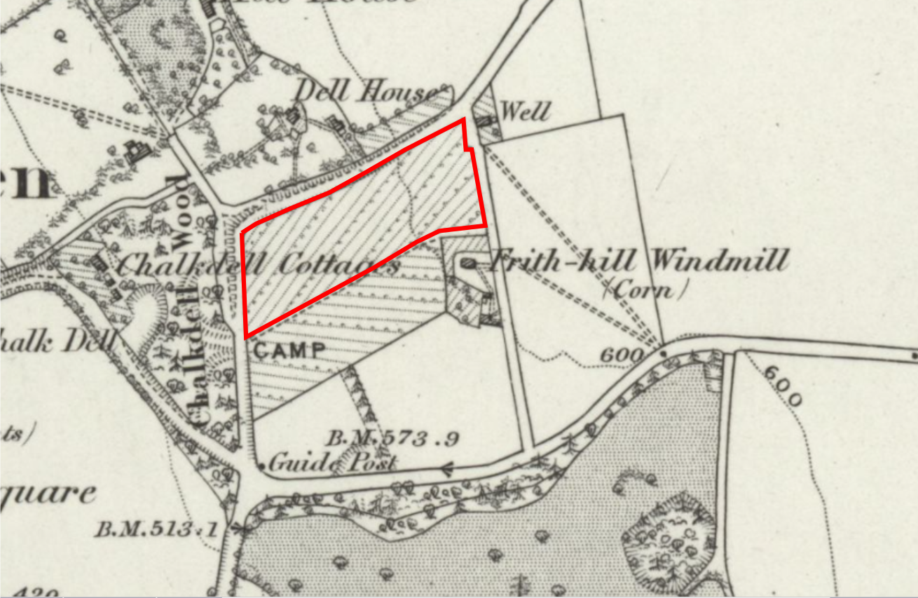
The geology of the site is clay with flints over chalk. As is often the case in our area, the clay is on top of the hills, and therefore so are the puddles! The camp is thought by Daniel Secker to be a medieval ringwork. There is a plan and discussion published in Records of Bucks for 1998.
Using the 1m Govt Open Access lidar data, I have created a simple relief model (SRM) of the area. The SRM “flattens out” the landscape and shows small variations against that flat background. It is ideal for showing small scale “lumps and bumps” such as the old field boundaries at Gorhambury. The initial output from a SRM is a bit flat visually, and so some form of hillshading (i.e., applying a virtual raking light) is needed. I have used a “multiview” hill shade. The results are shown in Figure 3.
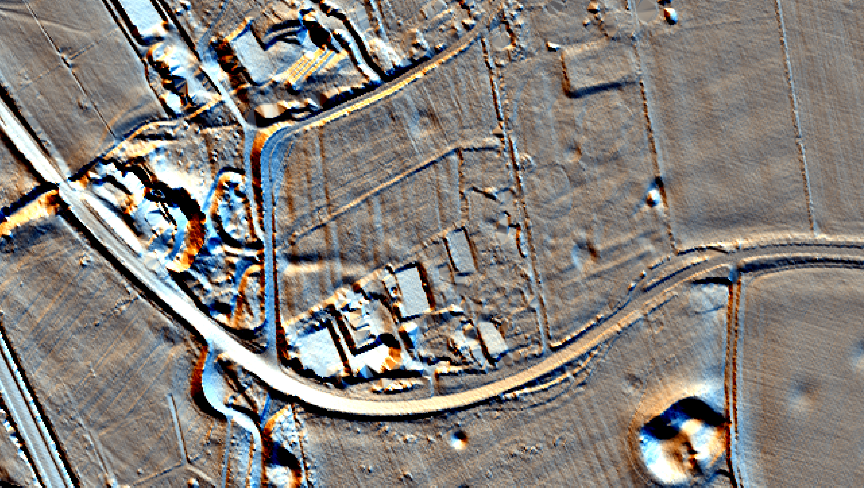
As can be seen from the lidar, the field has lots of linear features across it running roughly N-S, and slightly downhill. Are these be the remains of the “garden” shown on the OS map? There is also a shallow depression in the field which looks a bit like an inverted pimple. We could see this clearly as we were surveying.
Figure 4 shows the processed mag results.

As can be seen from the plot, the linear features seen in the lidar plots dominate the results. There is also a long linear feature running parallel to the southern fence which might be a drainage ditch.
There are some more subtle things in this field, and I have labelled them in Figure 5.

The red arrow in Figure 5 points to a concentration of ferrous noise. This is in the dip mentioned above. As this is not where the windmill was situated it must have another origin. I wonder if it is a clay pit which has been filled with rubbish? The two green lines overlay two very faint linear features which might be old and highly decayed services. There are a couple of poorly defined positive features marked with the blue arrows which might be a pit and a short length of ditch. The yellow arrow marks an area of low magnetism in an arc. I’m not sure what this might be. Finally, I’m probably grasping at straws, but are there two circles indicated by the orange arrows?
Sadly, given the proximity of the “camp” at the western edge of the site, the survey has been very inconclusive. As always with geophysics, the absence of evidence is not evidence of absence. It might be worth trying Earth resistance survey or GPR?
Many thanks to the team of Jim, Rhian and Mike, and especially to the land owner for allowing us to access his land for the survey.
