This post goes back into the deep prehistory of CAGG. Way back in 2015 we were contacted by the Eighth in the East project to see if we would be interested in doing some geophysics as part of one of their research days. The project, funded by the National Lottery Heritage Fund (as it is now called) ran from 2013 to 2016. In their own words:
It aimed to promote and record the built and social legacy of the 8th United States Army Air Force during their time here in the East of England in World War II.
https://www.americanairmuseum.com/user/8619
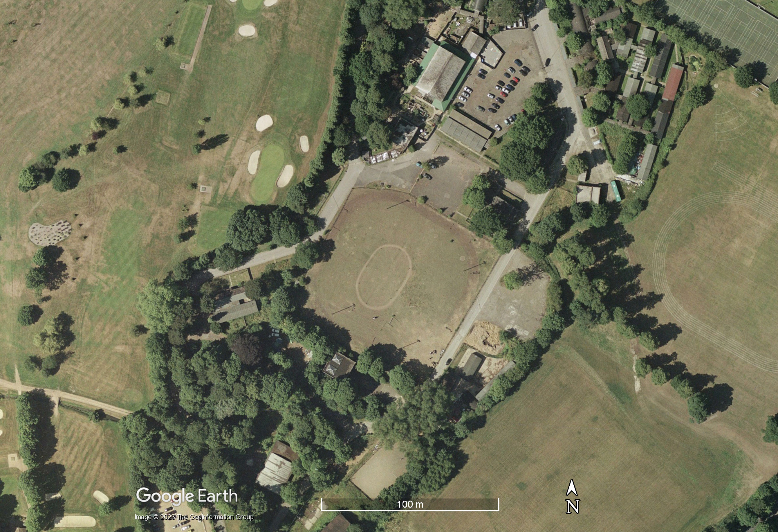
As is usually the case with lottery-funded projects, their website is now dead as the funding ran out to maintain it. We did two days of survey in late October 2015 in a small field on the edge of the site, completing both magnetometry survey and GPR survey. There was then an open day on the Sunday which we attended with some posters and a display of the equipment. The reason for the survey was because the Bushey Hall had been an 8th US Army Air Force base. Although the more temporary buildings survive (and are now used by the Forties Experience, Fig. 1) the main building had been demolished in the 1950s. Our survey was aimed at finding out if anything remained of the Hall.

You may ask why I am writing the blog almost eight years later? in 2015 the dGPS was a new toy and I was only just getting used to it (Fig. 2). Because the area we wanted to survey was small and at 45 degrees to the National Grid, I decided to use a “floating grid”. As wonderful as Leica dGPS units are, their manuals suck. I didn’t realise that to get the OS coordinates of points I laid in on my floating grid, I had to actually take a measurement at each point. Since Bushey, I have always taken a reading at each grid point and then worked out the maths to calculate the corners of the image of the survey which may be outside the area we have surveyed. I now end-up with three sets of coordinates for each corner: the floating grid, the OS coordinates (either measured or calculated) and then the lat/long coordinates for placing the image on Google Earth given by the OS’s website. For Bushey Hall I only had the floating coordinates and so could not place the survey in the correct place.

Slow-forward to yesterday. I finally gritted my teeth and motorcycled into Watford and went to Bushey Hall. Watford seems especially bad at road signs and as I don’t have a GPS for my motorcycle finding anything is a pain. After my magical mystery tour of Watford I found the site which has changed a great deal since we surveyed it. I then stood there trying to find the correct floating grid definition file. I was just about to give-up when in desperation I used one called “blaah”. Yay, it was the right one. I guess the name accurately sums-up how I felt about the process at the time. I wandered around the field locating old survey points and taking GPS readings. I also plotted a further five points just to be sure.
When I got home I downloaded the data in both floating grid point coordinates and OS coordinates. In Excel I edited the files so that both sets of coordinates for each point were on the same line. These were imported into the statistical program R where I ran a regression on the floating coordinates against the OS ones. They should be a perfect match (for stats nerds, r2 should be 1). Yay again, it worked. Having worked out the corners of the images from the two surveys in floating-grid coordinates, I can use the predict function in R to give me the OS coordinates. Having got those, I put them into a simple text file and uploaded them to the Ordnance Survey which converts them to lat/long and I can download a .csv file of the results. These I can then cut-and-paste into Google Earth to get the images in the right place. This stage always has me holding my breath… have I got everything right? Yay x 3. After eight years I finally have the images in the right place and can write this blog. Phew.
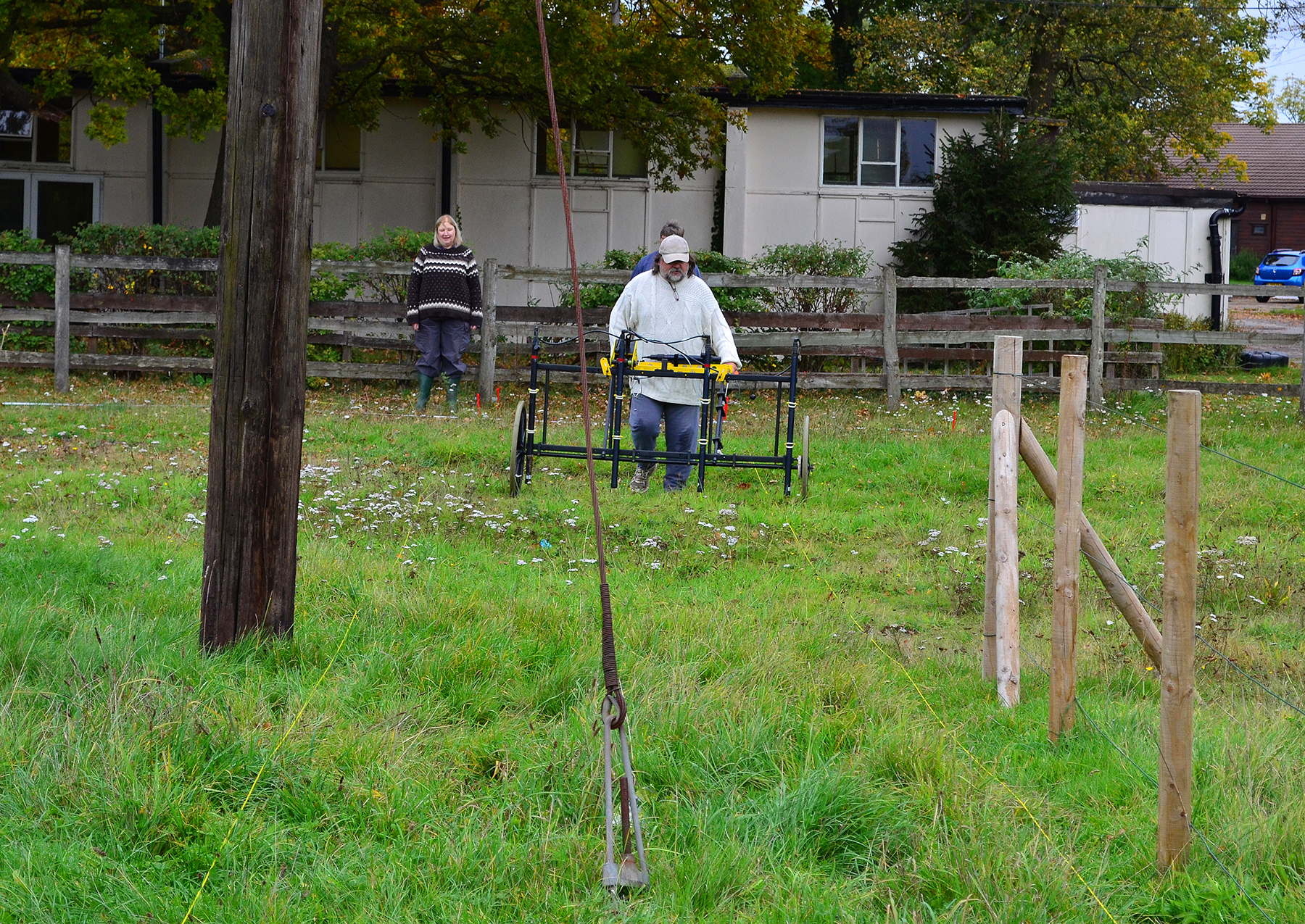
The mag survey was fiddly to complete as there were various obstructions in the way and a small area which involved some wheel spinning (Figs. 3 and 4).

Given this was a historic site, and that there were lots of modern things in the way, we expected the results to be full of strong magnetic features. We weren’t wrong (Fig. 5).

The red arrows in Figure 5 are the classic signature of ferrous services such as old waterpipes. There are four running across the site (the middle one looks like two side-by-side) as well as a funny L-shaped branch in the middle (perhaps to supply water to a standpipe or a fountain in the Hall’s gardens?). The blue arrows indicate smaller linear features. Given that this area is in the garden of the Hall, I suspect these are land drains. The mass of strong readings on the western side shown with the green arrow are typical of a historic site. Maybe this was the hall itself?
The GPR survey (Fig. 6) was very successful even if we had some issues during data collection (Fig. 7). The top slice (Fig. 8) shows two ovals, a very strong outer one and a fainter inner one.


The outer band of strong reflections (shown in red) are some sort of track. Even yesterday (25/08/2023) I could see parts of the concrete curb stones poking through the grass. The Google Earth image from September 1999 shows the two tracks quite clearly (Fig. 9) but zooming in (Fig. 10) doesn’t really give a clue what they were for. Probably some form of sport? The inner one looks quite ephemeral unlike the outer which I think was tarmac or cinder with concrete curb stones. It is quite impressive that something as ephemeral as the inner track survives well enough to be seen in the GPR data.

In Slice 3 (Fig. 11) some of the services that can be seen in Figure 4 can start to be seen, especially the land drains.

Time slices 4 onwards start to show the building foundations very clearly. Yes! We had found the remains of the Hall. Figure 12 shows all these slices (click for a larger view) and Figure 13 shows just slice 7.


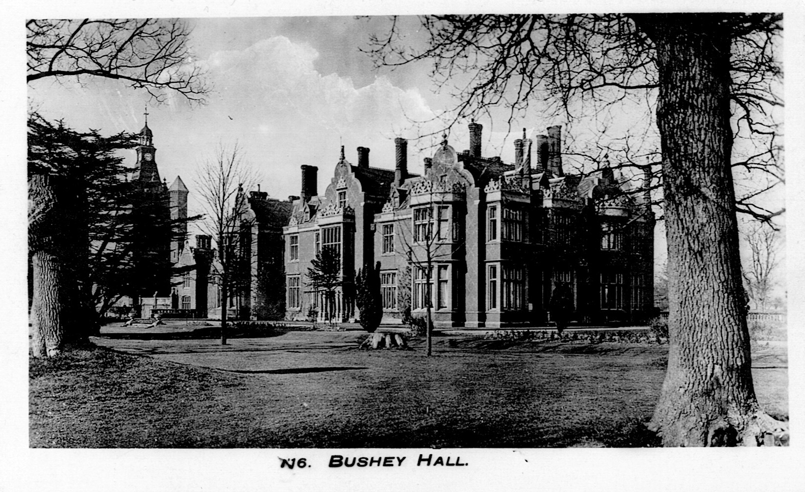
The earlier time slices 4 and 5 show some details to the west of the house which are probably remains of a garden terrace. Time slice 7 (Figure 13) shows the porte cochère on the north side of the house very nicely. It is remarkable how much detail from the internal plan of the house survives. How do we know so much about the house? As it wasn’t demolished until the 1950s, picture postcards are available (Figs. 14 and 15) and it appears on the OS maps up until the 1940s. It is not listed in J. T. Smith’s Hertfordshire Houses, unfortunately. The “Bushey Hall” listed there is the other Bushey Hall!

Google Earth provides an aerial image of the area dating to 1945 (Fig.16). The Britain from Above website has photographs too, here and here.

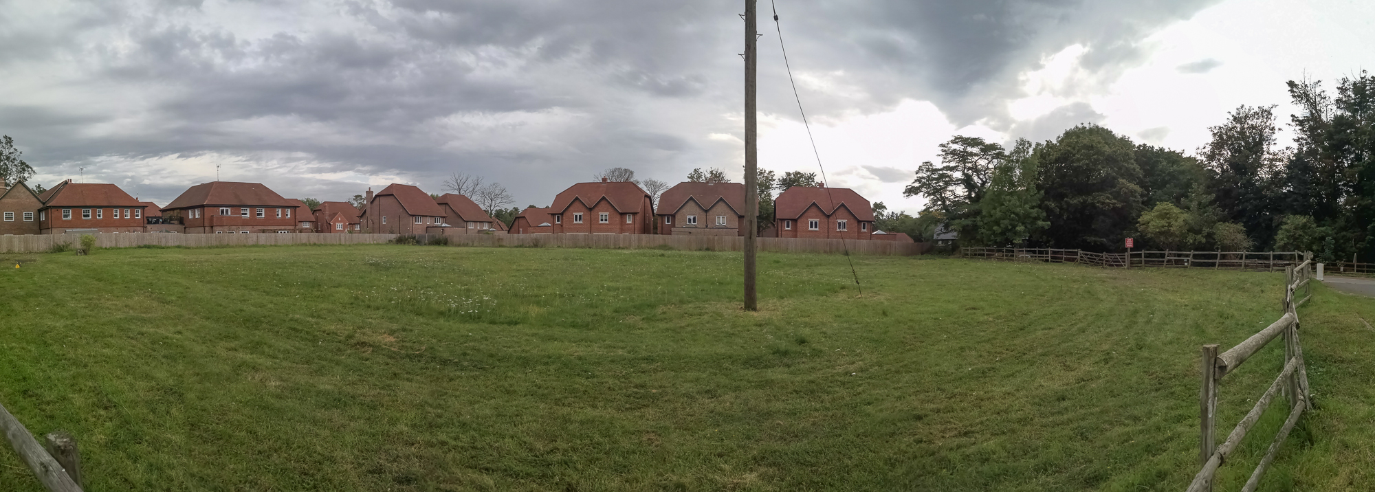
At the start of this posting I mentioned that the site has changed somewhat. Figure 17 shows a montage of Google Earth images from 2018 to 2022. As can be seen, a new development has built over the part of the area which we were not able to survey including the location of the bell tower. It also built over parts of the gardens which can be seen in the 1945 aerial (Fig. 16) including the semi-circular area on the SE of the garden. The new estate consists of the typical bland boring buildings which appear to be the hallmark of our era (Fig. 18). So dull compared to the extravagance of the Hall!

Well I guess that is one more job off my conscience. There are quite a few more so I guess I had better keep going… (Fig. 19).

